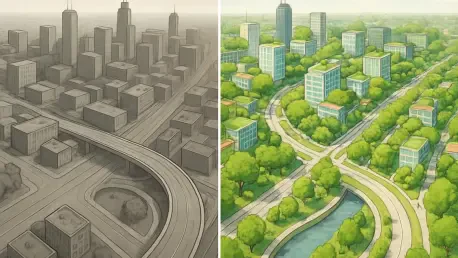

In today’s rapidly advancing technological landscape, artificial intelligence (AI) has increasingly become a vital tool in various fields, including urban planning and infrastructure assessment. A groundbreaking study by researchers at the University of Toronto has unveiled an innovative methodology that leverages AI to extract detailed information about buildings using Google Street View images. This technique offers an efficient, affordable alternative to traditional methods that often rely on costly map data and building plans. Focused primarily on the exteriors, it analyzes photographs to predict various characteristics such as age and floor area. Leading this research effort is Shoshanna Saxe, an associate professor in civil and mineral engineering, who has been driven by a goal to further embodied carbon research. However, the implications of this study extend far beyond, offering significant benefits to diverse domains involved in urban planning, water usage evaluation, and resilience studies. By harnessing the potential of AI and freely available photographic data, the study marks a potential shift in the way cities approach infrastructure challenges, making it possible to conduct large-scale assessments without exorbitant costs.
Revolutionizing Data Collection in Urban Planning
The research carried out by the University of Toronto promises to redefine how cities gather and utilize building data by employing AI-driven techniques. Traditional data collection methods often involve extensive surveys and reliance on building plans or maps, which are both costly and labor-intensive. By contrast, the AI model developed in this study utilizes publicly accessible Google Street View images to gather the necessary information, thereby slashing the expenses involved. Spending roughly $1,000, Saxe and her team were able to collect data that would typically require millions to acquire via conventional approaches. This not only democratizes access to essential infrastructure data but also enables municipalities with limited resources to partake in comprehensive urban planning and sustainability practices. Moreover, the approach emphasizes efficiency and scalability, offering urban planners a powerful tool to perform wide-ranging assessments of building characteristics across entire cityscapes. Thanks to AI, experts now have the ability to comprehend existing urban conditions with remarkable precision, formulating strategies that are informed by a more detailed understanding of resource distribution and infrastructure demands.
Precision AI Modeling and Embodied Carbon Analysis
A central element of this innovative research is the AI model trained to interpret building features from exterior images with significant accuracy. Boasting a 70% success rate for estimating a building’s age and an 80% accuracy for determining its floor areas, the AI surpasses the limitations associated with traditional blueprints and maps, providing a nuanced view of infrastructure demands. The insights derived from these analyses extend even further, offering a glimpse into the material composition and potential retrofit history of buildings, albeit indirectly. This understanding is particularly beneficial in evaluating embodied carbon associated with construction materials—carbon emissions generated from the production and transport of these resources. According to Saxe, knowing the building’s age can lead to insights into the materials used, with older structures potentially undergoing renovations involving different materials like brick, glass, or concrete. This knowledge is paramount for assessing carbon performance and implementing effective strategies for reducing emissions. With the ban on redundant and costly physical assessments, the AI’s ability to detect these elements through visual means represents a substantial advancement that could profoundly impact sustainability measures in urban settings.
Broader Implications for Future Infrastructure Planning
Beyond individual building assessments, the implications of integrating AI into urban planning extend across entire city infrastructures. Through its detailed overview of current resource conditions, this novel approach equips planners with essential tools for making informed decisions on future infrastructure projects. It has the potential to highlight underutilized resources and identify where infrastructure may not be meeting demand, allowing for timely interventions. This real-time ability to map the existing landscape closely aligns with the evolving needs of urban environments, even though it does not predict future scenarios. According to co-author Alex Olson, understanding the current distribution of resources in urban centers ensures preparedness for future expansion and development. Building facades are essentially unlocked by this technology, revealing the hidden details that inform numerous critical decisions about city infrastructure. Urban planners now have greater insight into the operational lifecycle of buildings and can implement solutions focused on enhancing efficiency and sustainability. Ultimately, these developments foster an environment of accurate, data-driven resource management, improving urban planning outcomes significantly.
A Transformative Shift in Urban Infrastructure Assessment
The study by the University of Toronto represents a transformative shift in the ways AI can be applied to urban infrastructure assessment and planning. The capacity to extract detailed building attributes from images captured by Google Street View transcends traditional techniques, delivering a comprehensive understanding necessary for effective resource management and sustainability. Through this AI-driven methodology, planners now have unprecedented access to data that allows them to conduct thorough analyses without relying on expensive surveys or manual inspections. The deeper comprehension of material usage and maintenance behaviors translates into precise assessments of embodied carbon, further contributing to environmentally responsible planning. As cities strive to balance growth and sustainability, these innovations serve as a vital cornerstone for informed decision-making that prioritizes both immediate needs and long-term ecological health. In essence, the leap forward encapsulated by this research not only enhances city planners’ capabilities but also sets a future-oriented precedent for incorporating AI into various fields of civil engineering and urban development.
Embracing Technological Advancements for Sustainable Cities
In today’s swiftly evolving tech environment, artificial intelligence (AI) has emerged as a crucial asset in areas like urban planning and infrastructure evaluation. A pioneering study from the University of Toronto has introduced a novel approach using AI to extract detailed data about buildings through Google Street View images. This method presents a cost-effective alternative to traditional techniques that typically depend on pricey map data and building plans. Focusing on building exteriors, it uses images to predict features such as building age and floor space. Spearheading this research is Shoshanna Saxe, an associate professor in civil and mineral engineering, driven by a desire to advance embodied carbon research. Yet, the study’s reach extends far beyond, offering valuable insights to fields such as urban planning, water usage analysis, and resilience studies. By utilizing AI and widely accessible photographic data, the study signifies a potential shift in how cities tackle infrastructure issues, enabling large-scale assessments without prohibitive expenses.