
Unlocking Safety in a Shaking World
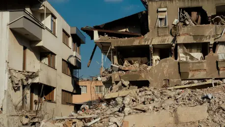
What if the secret to protecting millions from the devastation of earthquakes lies not in endless drilling and testing, but in the quiet hum of algorithms processing data at lightning speed? Earthquakes remain one of nature’s most destructive forces, claiming lives and shattering infrastructure in mere moments. In densely populated urban centers, the stakes are higher than ever, with soil liquefaction—a phenomenon where solid ground turns to liquid during seismic activity—posing an unseen threat to towering structures. This hidden danger demands a smarter approach to risk assessment, one that can keep pace with rapid urbanization and complex geological challenges. Enter machine learning (ML), a technology poised to transform how earthquake risks are predicted and mitigated.
The urgency of this innovation cannot be overstated. Traditional methods, while dependable on smaller scales, often fall short when applied to sprawling metropolitan areas. With cities expanding and populations soaring, the need for scalable, efficient solutions has never been more critical. This exploration dives into how ML offers a groundbreaking path forward, promising to redefine safety standards in geotechnical engineering with precision and speed previously unimaginable.
The Growing Threat in Urban Centers
Urban landscapes, especially in earthquake-prone regions like Tokyo, face escalating risks as populations concentrate in tighter spaces. Historical events, such as the catastrophic 1923 Great Kanto Earthquake, serve as stark reminders of the devastation seismic activity can unleash, reshaping entire cities and policies in its wake. Today, the danger is compounded by soil liquefaction, which can undermine even the sturdiest foundations during tremors, turning stable ground into a deadly trap for buildings and inhabitants alike.
Compounding this challenge is the sheer scale of modern cities. As skyscrapers rise and infrastructure networks expand, pinpointing vulnerabilities like bearing layer depth—the level at which soil or rock can support structures—becomes paramount. Yet, conventional tools like the Standard Penetration Test (SPT) struggle to meet the demands of large-scale analysis due to their labor-intensive and costly nature. This gap in capability highlights a pressing need for innovative methods that can handle the complexity of urban environments without breaking budgets or timelines.
Revolutionizing Predictions with Algorithms
Machine learning emerges as a transformative force in tackling these geotechnical challenges. By harnessing algorithms such as Random Forest (RF), Artificial Neural Networks (ANN), and Support Vector Machines (SVM), ML can predict bearing layer depth with remarkable accuracy, drawing from extensive geological survey records. For instance, studies using 942 data points from Tokyo have shown RF achieving a mean absolute error of just 0.86 meters when enriched with detailed soil layer information, far surpassing the efficiency of manual testing.
Beyond precision, ML offers scalability that traditional approaches cannot match. Unlike SPT, which requires extensive fieldwork, these algorithms process vast datasets swiftly, slashing both time and cost. The inclusion of stratigraphic classification—data on underground soil layers—further boosts prediction reliability, particularly for RF models, ensuring that urban planners have access to actionable insights for regional assessments.
Another critical advantage lies in data density. Research indicates that increasing spatial data points to around 3.0 per square kilometer significantly enhances ML model performance. This finding underscores the importance of comprehensive data collection, paving the way for more robust risk mapping across sprawling cityscapes. Such capabilities position ML as a cornerstone for future-proofing urban infrastructure against seismic threats.
Voices from the Field and Real Impact
Experts in geotechnical engineering are vocal about the potential of ML to reshape disaster preparedness. Professor Shinya Inazumi from a leading Japanese institute has emphasized, “This technology equips urban planners with the tools to make informed decisions on site selection for critical infrastructure.” Such endorsements lend weight to the growing trust in data-driven solutions, highlighting their role in preventing catastrophic failures.
Real-world applications further illustrate this promise. In Tokyo’s metropolitan area, ML models have been rigorously tested with geological data, identifying at-risk zones with a precision that manual methods struggle to achieve. Reflecting on past disasters, where entire neighborhoods were lost to unforeseen ground failures, it becomes clear that such predictive power could avert future tragedies. These practical examples demonstrate how algorithms can translate into tangible safety gains, protecting lives and investments in vulnerable regions.
Steps to Integrate Smart Technology into Risk Strategies
Adopting machine learning for earthquake risk assessment is not an insurmountable task for urban planners and engineers. A starting point lies in utilizing existing geological surveys and SPT records to train models like Random Forest, prioritizing the integration of detailed stratigraphic data to maximize accuracy. This approach ensures that foundational insights are built on readily available resources, minimizing initial hurdles.
Further progress hinges on enhancing data collection efforts. Targeting a spatial data density of at least 3.0 points per square kilometer in high-risk zones can significantly improve prediction outcomes, providing a clearer picture of subsurface vulnerabilities. Simultaneously, selecting robust algorithms like RF, known for handling complex and noisy datasets effectively, offers a reliable path to consistent results over alternatives like ANN or SVM.
Collaboration and integration are equally vital. Linking ML models to real-time systems enables rapid risk evaluations during planning phases or post-disaster recovery, while partnerships between geotechnical experts and data scientists can refine these tools to suit local conditions. Such coordinated efforts lay the groundwork for building resilient cities, capable of withstanding the unpredictable nature of seismic events through informed, technology-driven strategies.
Reflecting on a Safer Path Forward
Looking back, the journey toward integrating machine learning into earthquake risk assessment marked a pivotal shift in geotechnical engineering. The demonstrated accuracy of algorithms like Random Forest, coupled with their ability to scale across vast urban areas, offered a lifeline to cities grappling with seismic uncertainties. This technological leap addressed longstanding gaps left by traditional methods, proving that data could indeed fortify foundations as much as concrete.
Moving ahead, the focus shifts to actionable implementation. Stakeholders are encouraged to invest in denser data networks and foster interdisciplinary collaborations, ensuring that ML tools adapt seamlessly to diverse environments. Additionally, exploring integrations with real-time monitoring systems promises to elevate rapid response capabilities. These steps, grounded in the insights gained, aim to build not just safer structures, but entire communities resilient to the tremors of tomorrow.