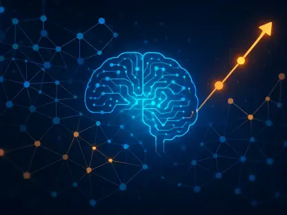

In an era where geospatial data underpins critical applications like urban planning, disaster response, and infrastructure development, the demand for faster, more accurate processing has never been higher, and every day, professionals in surveying, mapping, and inspection grapple with massive datasets from sensors, imagery, and point clouds, often facing bottlenecks with traditional computing systems. Enter neural processing units (NPUs), a revolutionary technology designed to accelerate artificial intelligence tasks and address these challenges head-on. By mimicking the brain’s neural interactions, NPUs offer a specialized approach to handling complex computations directly on hardware, slashing latency and boosting efficiency. This advancement holds the promise of transforming how geospatial data is processed, analyzed, and acted upon, particularly in real-time scenarios. As the industry seeks smarter solutions, the potential of NPUs to redefine workflows and elevate outcomes is becoming increasingly clear, paving the way for a new era of innovation.
Accelerating Data Processing with NPUs
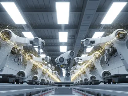
The geospatial sector thrives on the ability to process vast amounts of data swiftly, a task that often overwhelms conventional CPUs and GPUs due to their general-purpose architecture. NPUs, however, are engineered specifically for AI workloads, enabling rapid execution of neural network operations with unparalleled speed. This capability is a game-changer for applications requiring immediate analysis, such as real-time mapping or autonomous navigation systems. By performing computations directly on the device rather than relying on external servers or cloud infrastructure, NPUs minimize delays and enhance operational efficiency. This shift is particularly vital for field operations where connectivity may be limited or unreliable. As geospatial tools increasingly integrate AI for tasks like object detection or terrain analysis, the role of NPUs in delivering seamless, on-the-spot processing cannot be overstated, marking a significant leap forward in handling data-intensive workflows with precision.
Beyond speed, the efficiency of NPUs offers a compelling advantage for geospatial equipment, especially in rugged or remote environments where power constraints are a constant concern. Unlike GPUs, which consume substantial energy and often require robust cooling systems, NPUs are designed for low-power operation, making them ideal for battery-powered devices used in the field. This energy efficiency translates to longer operational times for portable tools, reducing downtime and enhancing productivity. Moreover, their compact design allows for integration into smaller, lighter instruments without sacrificing performance. Such advancements enable geospatial professionals to carry out complex AI-driven tasks, like processing high-resolution imagery or sensor data, directly on-site. The result is a more agile workflow that adapts to the demands of dynamic projects, ensuring that critical insights are available when and where they are needed most, without the burden of heavy or power-hungry hardware.
Empowering Edge Devices for Field Operations
One of the most transformative aspects of NPUs lies in their ability to bring powerful AI capabilities to edge devices, a crucial development for geospatial fieldwork. These specialized processors excel at low-latency parallel computing, allowing simultaneous processing of diverse data inputs like imagery and sensor readings right at the point of collection. This is particularly beneficial for autonomous systems or portable tools that must make split-second decisions without constant internet access. For instance, instruments equipped with NPUs can analyze environmental conditions or detect anomalies in real time, enhancing safety and accuracy during surveys or inspections. By embedding such intelligence directly into field equipment, NPUs eliminate the need for data to be sent to distant servers for processing, thereby reducing dependency on network infrastructure and ensuring uninterrupted operations even in the most isolated locations.
The practical implications of NPUs in edge devices extend to their adaptability across a range of geospatial applications, from urban mapping to disaster assessment. Their lightweight and power-efficient nature makes them suitable for integration into handheld or drone-mounted systems, which often operate under strict weight and energy limitations. This adaptability empowers professionals to deploy advanced AI functionalities, such as real-time object recognition or path planning, directly in the field. A notable example is their use in cutting-edge surveying instruments that leverage onboard NPUs to process data instantly, streamlining decision-making processes. As a result, teams can respond to evolving conditions with greater agility, whether monitoring infrastructure stability or mapping disaster-stricken areas. This shift toward smarter, self-reliant devices underscores how NPUs are redefining the boundaries of what is possible in geospatial operations, fostering a more responsive and efficient approach to data handling.
Unlocking Advanced Modeling Techniques
NPUs are also poised to revolutionize geospatial technology through their support for sophisticated modeling methods like Neural Radiance Fields (NeRFs), which reconstruct detailed 3D scenes from 2D images. Traditional photogrammetry often struggles in challenging conditions, such as low-light environments or areas with intricate geometries, leading to incomplete or inaccurate models. NeRFs, powered by the computational prowess of NPUs, overcome these limitations by generating highly precise 3D representations even in suboptimal settings. This capability allows geospatial professionals to create detailed visualizations on-site, significantly enhancing the quality of outputs for applications like architectural planning or heritage preservation. By accelerating the complex calculations required for NeRFs, NPUs ensure that such advanced modeling becomes a practical tool rather than a time-intensive process, opening new avenues for innovation in data interpretation.
The impact of NPUs on advanced modeling extends beyond technical precision to fundamentally alter how geospatial workflows are structured. With the ability to process and render complex 3D models directly on devices, professionals can bypass the traditional pipeline of data collection, off-site analysis, and delayed reporting. This immediacy not only saves time but also enables iterative adjustments during field operations, ensuring that models reflect real-world conditions with greater fidelity. For industries reliant on accurate spatial data, such as construction or environmental monitoring, this represents a paradigm shift toward more dynamic and responsive practices. The integration of NPUs into geospatial tools thus facilitates a seamless transition from raw data to actionable 3D insights, empowering teams to tackle complex challenges with confidence. As these technologies mature, their role in pushing the boundaries of spatial analysis will likely become even more pronounced, setting new standards for accuracy and efficiency.
Shaping the Future of Geospatial Intelligence
Looking back, the integration of neural processing units into geospatial technology marked a pivotal moment, addressing longstanding challenges in data processing speed and efficiency. Their ability to handle AI-driven tasks on edge devices redefined autonomy in the field, enabling real-time decision-making that was once unimaginable without robust connectivity. The support for cutting-edge techniques like Neural Radiance Fields further elevated the precision of 3D modeling, transforming how spatial data was visualized and utilized across industries. Reflecting on these advancements, it became evident that NPUs catalyzed a significant evolution in geospatial workflows, bridging the gap between data capture and actionable intelligence with remarkable finesse. As adoption grew, their influence on creating smarter, more connected tools reshaped professional practices, setting a foundation for continuous improvement in how spatial insights were derived and applied.
Moving forward, the focus should center on scaling the adoption of NPUs across diverse geospatial applications, ensuring that their benefits reach smaller organizations and specialized niches. Investment in research to optimize NPU performance for even more complex AI algorithms could unlock additional capabilities, further enhancing on-device learning and adaptive decision-making. Collaboration between technology developers and geospatial experts will be essential to tailor solutions that address specific industry pain points, from power efficiency in remote operations to real-time analytics in urban settings. Additionally, training programs to familiarize professionals with NPU-enabled tools can accelerate integration into everyday workflows. By prioritizing these steps, the geospatial community can build on past achievements, driving innovation that not only meets current demands but also anticipates future challenges, ensuring that the full potential of neural processing is realized in transforming spatial intelligence.