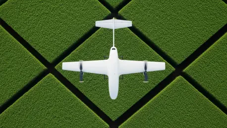

Modern large-scale industrial farming operations frequently struggle with the logistical constraints of manual field mapping and the inherent unpredictability of natural growth cycles which can render pre-planned flight paths obsolete within a matter of days or even hours. To solve this persistent challenge, GEODASH Aerosystems has introduced a sophisticated autonomous platform that prioritizes machine intelligence over mere hardware capacity. This joint venture between DroneDash Technologies and GEODNET represents a significant departure from traditional agricultural drone deployment, focusing on systems that can perceive and react to their environment in real time. By moving away from labor-intensive preparation stages, the technology enables operators to cover vast palm oil plantations and row-crop estates with unprecedented efficiency. The primary objective is to eliminate the bottlenecks associated with the manual generation of flight plans, allowing the aircraft to navigate complex and changing landscapes without constant human intervention or pre-flight surveys.
Revolutionizing Navigation with Real-Time Perception
Transitioning from Deterministic to Autonomous Flight
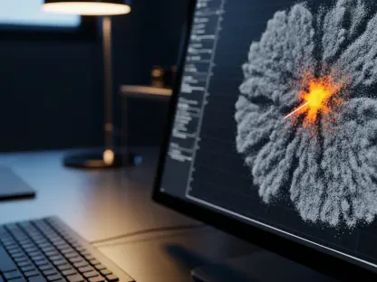
Conventional agricultural drones have historically relied on a deterministic approach where operators must physically survey a field to generate a specific digital map before any chemicals can be applied. This process is not only time-consuming but also fails to account for the natural dynamism of a working farm where plant growth, pruning, or even soil erosion can alter the terrain between scheduled flights. The new GEODASH system effectively replaces these static models with an AI-driven vision system that allows the aircraft to “see” and interpret its surroundings as it moves. By processing visual data on the fly, the drone can identify individual rows, specific trees, and unforeseen obstacles without needing a pre-existing map of the area. This capability ensures that the mission remains accurate even if the physical environment has changed significantly since the last operation, thereby reducing the risk of collisions and improving the precision of the spraying application.
The technological shift toward real-time perception is particularly critical for the dense and often chaotic environments found in Southeast Asian palm oil plantations. In these settings, traditional GPS-based navigation often struggles with signal interference or lack of detailed topological data, making autonomous flight a risky endeavor without advanced sensors. The integration of DroneDash’s AI vision system allows the drone to maintain a consistent altitude and orientation by recognizing the geometric patterns of the canopy and the ground below. This level of autonomy means that the aircraft no longer requires a rigid, pre-defined path to follow, as it can make localized adjustments to its trajectory to ensure optimal coverage. Consequently, the operational burden on the ground crew is significantly lightened, as they can focus on high-level mission oversight rather than the minutiae of path planning. This creates a more scalable model for industrial farming where dozens of drones may need to operate across thousands of acres simultaneously.
Achieving Centimeter-Level Precision with GEODNET
While visual perception provides the drone with the ability to understand its immediate surroundings, the necessity for extreme geographic accuracy remains a cornerstone of effective precision agriculture. GEODASH utilizes the GEODNET network to provide centimeter-level positioning technology, which acts as the digital backbone for every mission carried out by the autonomous fleet. This global navigation satellite system enhancement ensures that the drone knows its exact location in three-dimensional space, allowing it to apply treatments with surgical precision. When this high-accuracy positioning is paired with real-time vision, the aircraft can execute complex maneuvers, such as navigating between tight rows of crops or avoiding low-hanging branches, with a degree of confidence that was previously impossible. This synergy between global positioning and local sensing allows for a more robust flight profile that minimizes overlap and gaps in chemical application, directly leading to better crop yields and lower chemical waste.
This advanced positioning framework is also essential for maintaining the integrity of the data collected during the flight, as every sensor reading must be georeferenced with absolute accuracy to be useful for long-term farm management. In the expansive row-crop estates of the Americas, where fields can stretch for miles, the ability to maintain a precise location relative to the soil and the plant life is the difference between a successful harvest and a costly error. The GEODNET integration allows the system to remain stable even in areas with sparse terrestrial landmarks, providing a reliable reference point that the AI can use to calibrate its visual findings. As a result, the drone functions as a cohesive unit that understands both its place in the world and its immediate relationship to the crops it is servicing. This dual-layered approach to navigation represents the current gold standard in aerial robotics, moving the industry toward a future where machines operate with the same spatial awareness as a human pilot.
Transforming Drones into Intelligence Hubs
Harnessing Dual-Purpose Aerial Sensor Platforms
The modern agricultural drone is no longer just a flying tank for liquid chemicals; it has evolved into a sophisticated dual-purpose sensor platform that generates a continuous stream of actionable intelligence. As the GEODASH aircraft traverses the field, it utilizes its high-resolution cameras and multispectral sensors to gather data on canopy density, plant health, and the overall effectiveness of the spray application. This information is not merely stored for later review but is processed through a backend AI system that identifies areas of concern, such as pest infestations or nutrient deficiencies, in real time. This transition allows farm managers to pivot from a reactive maintenance schedule to a proactive, data-driven strategy that addresses issues before they can impact the bottom line. By turning every spraying mission into a data-gathering exercise, the platform maximizes the return on investment for every hour the aircraft is in the air, creating a more holistic view of the farm’s ecosystem.
Furthermore, the data collected by these autonomous systems provides a level of granularity that ground-based inspections simply cannot match, especially over hundreds of hectares of difficult terrain. The AI can detect subtle changes in leaf color or growth patterns that might be invisible to the naked eye, allowing for highly targeted fertilization or pesticide use. This precision not only saves money on raw materials but also contributes to a more sustainable farming model by reducing the overall chemical footprint of the operation. The backend analytics platform can also track the long-term health of the plantation, providing historical insights that help managers plan for future replanting or irrigation upgrades. This shift from simple tool to intelligence hub reflects a broader trend in robotics where the value of the machine is increasingly defined by the quality of the data it provides rather than its mechanical functions. The ability to interpret and react to biological signals makes these drones indispensable partners in the modern agricultural workflow.
Optimizing Logistics and Scaling Commercial Operations
The logistical advantages of an autonomous system that does not require pre-flight mapping are most evident when considering the total cost of ownership and the speed of deployment for large industrial estates. Because the drone can function within geo-fenced boundaries without a static map, it can be deployed to new or changing fields with almost zero lead time, which is a massive improvement over traditional workflows. The aircraft is programmed to adjust its altitude and spray rates on the fly based on the density of the vegetation it encounters, ensuring that every plant receives the exact amount of treatment required. Every decision made by the AI, from obstacle avoidance to rate adjustment, is logged and uploaded for human review to maintain a rigorous standard of quality control and regulatory compliance. This transparency ensures that while the machine is making the day-to-day tactical decisions, the human operator retains full strategic oversight of the entire operation across the estate.
Following the extensive validation phase that took place throughout 2025, the commercial rollout scheduled for the third quarter of 2026 marks a pivotal moment for the industry as it moves toward widespread adoption of AI-led farming. The collaboration between DroneDash and GEODNET has demonstrated that the future of agricultural efficiency lies in the marriage of high-precision location data and real-time visual processing. For farm managers looking to stay competitive, the move toward these autonomous systems is no longer a luxury but a necessity for managing the scale and complexity of modern food production. The implementation of this technology reduces the reliance on a shrinking agricultural workforce while simultaneously increasing the precision and sustainability of farming practices. Ultimately, the success of the GEODASH project underscored the industry consensus that the next generation of productivity will be driven by machines capable of interpreting the natural world with the same nuance and adaptability as the humans who previously managed them.