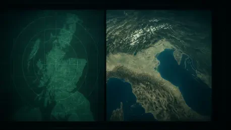

The research team opted to build a custom foundation model rather than adapting existing artistic AI, focusing specifically on the unique geometry of overhead perspectives. This initiative by the Korea Advanced Institute of Science and Technology marks a transformative shift in orbital observation, moving away from simple image enhancement toward deep semantic reconstruction. For decades, the inability to see through persistent cloud layers has left critical data gaps in meteorology and environmental surveillance. By leveraging a massive nine-billion-parameter architecture, the researchers created a system that perceives the Earth not as a collection of pixels, but as a structured environment with predictable physical properties. This breakthrough allows for the synthesis of high-fidelity optical views even when the ground is completely shrouded by heavy atmospheric interference. The scale of parameters enables the model to understand complex relationships between topography and land use, effectively removing the weather-dependent limitations.
The Core Challenge: Visibility and Interpretability
Optical satellite imagery serves as the primary window into planetary changes, yet its efficacy remains tethered to the whims of local weather patterns. On any given day, nearly two-thirds of the Earth’s surface is obscured by clouds, rendering traditional sensors incapable of capturing ground-level details. While synthetic aperture radar (SAR) provides a workaround by using radio waves that penetrate atmospheric moisture, the resulting output is far from user-friendly. SAR data often appears as a monochromatic, speckled mess of textures that requires years of specialized training to interpret correctly. A typical urban landscape in radar format might look like a chaotic collection of bright flares and deep shadows, making it nearly impossible for emergency responders or urban planners to identify specific buildings or road damage without manual assistance. The fundamental mission of the new system is to bridge this gap, ensuring that visibility is no longer a privilege of clear skies.
Beyond the physical barrier of clouds, the cognitive load required to process non-optical data presents a significant bottleneck for global monitoring efforts. In high-stakes scenarios such as flood monitoring or wildfire tracking, time is the most valuable resource, and the delay caused by converting radar signals into actionable intelligence can have dire consequences. The KAIST team recognized that a modern solution must not only see through the clouds but also translate that vision into a familiar format. By utilizing a generative approach, the model acts as a sophisticated visual translator, reconstructing the “missing” optical data by referencing the structural patterns detected by radar sensors. This allows a user to look at a radar-derived image and see the recognizable colors of vegetation, the clear lines of infrastructure, and the distinct shimmer of water bodies. This translation layer effectively democratizes satellite data, allowing non-experts to make critical decisions.
Structural Innovations: Semantic Awareness and Scale
To achieve such high levels of accuracy, the development process moved beyond general-purpose artificial intelligence and toward a domain-specific foundation model. The training phase involved an enormous corpus of 10 million satellite image pairs, each meticulously matched with descriptive text to provide the AI with a semantic framework. Unlike models trained on internet photos of cats or landscapes, this system learned the specific spatial logic of the Earth’s surface from a top-down perspective. It developed an inherent understanding of how a shipping port differs from a residential neighborhood and how seasonal changes affect the visual signature of agricultural land. This deep learning process allowed the model to internalize the visual grammar of geography. Consequently, when the model encounters a cloud-covered region, it does not simply guess what lies beneath; it uses its vast library of planetary patterns to hypothesize the most likely ground configuration.
A critical breakthrough in this architecture is the integration of geospatial metadata, including specific latitude, longitude, and Ground Sample Distance (GSD). In the world of remote sensing, scale is everything, as a single pixel can represent anywhere from thirty centimeters to several meters of actual terrain. By feeding this coordinate and resolution data directly into the neural network, the researchers ensured the AI maintains a strict adherence to physical proportions. Without this contextual data, AI models frequently hallucinate details that are physically impossible or sized incorrectly for the given resolution. For example, knowing the GSD prevents the system from confusing a cluster of small cars with a single large bus in a low-resolution shot. This spatial awareness transforms the generator from an artistic tool into a scientific instrument, ensuring that the final images are not just aesthetically pleasing but are geographically and dimensionally accurate.
Optimizing Performance: Training and Adaptation Efficiency
Maintaining structural integrity within a generated image requires more than just high-level pattern recognition; it demands a focus on the underlying geometry of the environment. To solve this, the researchers implemented a technique called Geospatial Semantic Alignment, which utilizes a secondary AI during the training phase to extract “structural skeletons.” These skeletons represent the rigid frameworks of human civilization and natural geography, such as property boundaries, arterial road networks, and riverbanks. By aligning the generative process with these fixed markers, the model ensures that the resulting images are not just blurry approximations but sharp, logically consistent maps. Importantly, this auxiliary network is decoupled from the main system once training is complete. This means the final model retains all the learned structural knowledge without the added computational burden, allowing for rapid image generation on standard server hardware without sacrificing precision.
Efficiency was further prioritized through the implementation of Low-Rank Adaptation (LoRA), a strategy that allows the 9-billion-parameter core to remain static while specialized tasks are fine-tuned. Traditionally, training an AI for a specific job like radar-to-optical conversion would require adjusting every single parameter, a process that is both prohibitively expensive and time-consuming. With LoRA, the KAIST team could pivot the model between cloud removal and radar interpretation by only training a small fraction of the total parameters. This modular approach significantly lowers the barrier for future updates and specific regional adaptations. In comparative testing against previous state-of-the-art models, this method proved superior in maintaining color fidelity and structural similarity. The AI demonstrated a remarkable ability to preserve the fine details of the terrain, producing outputs that were virtually indistinguishable from clear-sky optical captures.
Real-World Implications: Deployment and Future Trajectories
The potential for real-world deployment is particularly profound in the sector of disaster response and recovery. When a catastrophic event occurs, such as a major typhoon or a localized flood, the very weather systems causing the damage often prevent traditional satellites from assessing the extent of the impact. By utilizing the radar-to-optical conversion capabilities of the new model, emergency management agencies can obtain clear, high-definition views of the disaster zone in near real-time, regardless of the ongoing storm or the time of day. This allows for the immediate identification of collapsed bridges, blocked transit routes, and submerged residential areas. Beyond immediate crises, the technology offers a revolutionary tool for environmental monitoring in the tropics, where persistent cloud cover has long frustrated efforts to track illegal logging. Continuous, clear observation of these sensitive ecosystems is now possible, providing a higher level of global accountability.
The project concluded by establishing a new benchmark for how foundation models can be utilized to solve long-standing bottlenecks in Earth observation. Research leaders emphasized that the successful integration of geospatial awareness into generative AI proved to be the decisive factor in achieving scientific-grade accuracy. Moving forward, the focus shifted toward expanding these capabilities to a broader spectrum of sensor types beyond standard SAR and optical data. Industry professionals should have considered integrating these generative frameworks into existing GIS workflows to enhance the reliability of their spatial analysis. The study suggested that organizations must move away from a reliance on clear-weather windows and instead invest in multi-modal AI architectures that treat atmospheric interference as a solvable data problem rather than an insurmountable barrier. By standardizing the use of scale-aware models, the global community ensured that monitoring remained constant.