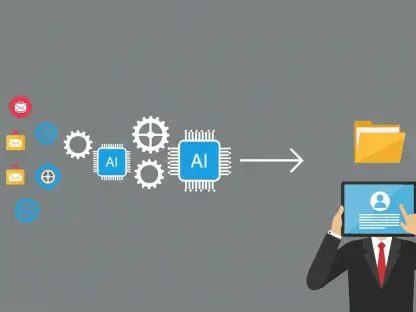
NASA, in collaboration with Microsoft, has announced the launch of an innovative AI tool named Earth Copilot. This groundbreaking tool is designed to simplify access to NASA’s extensive satellite data repository, transforming the way climate, geospatial, and Earth science data is accessed by scientists, researchers, and the public. Developed with the help of Microsoft’s Azure OpenAI Service, Earth Copilot allows users to retrieve data by posing questions in plain, natural language, significantly reducing the advanced technical skills traditionally required for data analysis.
Democratizing Access to Earth Science Data
The primary goal of Earth Copilot is to democratize access to NASA’s Earth Science data, which exceeds 100 petabytes. Historically, accessing and analyzing this data required advanced technical skills, making it less accessible to those without extensive expertise in data analysis. However, Earth Copilot breaks these barriers by allowing users to simply ask questions such as, “What was the impact of Hurricane Ian in Sanibel Island?” and receive accurate and relevant data swiftly. This development paves the way for a wider audience to engage with and utilize NASA’s vast data archives.
Juan Carlos López, an Azure Specialist and former NASA engineer, highlighted the efficiency of this AI-driven system in managing complex queries and substantial datasets. He emphasized that the system is designed for efficiency, ensuring users can find the information they need without the burden of technical complexities. Scalability is a key feature of Earth Copilot, as it evolves in tandem with NASA’s expanding data, tools, and applications. This adaptability ensures that as the data grows and advances, the tool remains effective and user-friendly, facilitating ever-easier access for a variety of users.
Integration with NASA’s VEDA Platform
Aligned with NASA’s Open Science initiative, Earth Copilot promotes research accessibility and collaborative engagement. The tool is set to be integrated into NASA’s Visualization, Exploration, and Data Analysis (VEDA) platform, which is currently undergoing rigorous testing. This integration aims to ensure the tool’s accuracy, security, and reliability before its public launch, thereby guaranteeing high-quality outputs for user queries.
The potential impact of Earth Copilot spans various sectors beyond research. For instance, in education, the tool can bring real-world environmental data to classrooms, potentially sparking student interest in Earth Sciences and fostering the next generation of climate scientists. Agricultural experts can use it to access crucial insights about soil moisture levels, aiding in better crop management and sustainable farming practices. Urban planners can utilize the climate data provided by Earth Copilot to develop sustainable city infrastructures, leading to more resilient and adaptable urban environments. Additionally, Minh Nguyen, Microsoft’s Cloud Solution Architect, emphasized the importance of leveraging AI and cloud technologies to bring valuable Earth insights to historically underserved communities, fostering tangible improvements in these areas.
Historical Collaborations and Technological Foundations
The foundation for the partnership between NASA and Microsoft has been laid through several historical collaborations showcasing the synergy between the two organizations. In February 2021, the launch of Spaceborne Computer-2 developed by Hewlett Packard Enterprise (HPE) and integrated with Microsoft’s Azure marked a significant step towards space-based edge computing. This project enabled real-time data processing aboard the International Space Station, benefiting fields such as weather modeling and medical research by providing timely and accurate data essential for various scientific inquiries.
Another notable collaboration is the integration of augmented reality technologies, particularly with NASA’s Mars Rover project. Utilizing Microsoft’s HoloLens and its ProtoSpace app, engineers could visualize spacecraft designs in full scale and interact with 3D models. This innovative use of augmented reality optimized design processes, improved mission efficiency, and facilitated more effective planning and execution of space missions. These historical collaborations have built a strong foundation upon which Earth Copilot stands and demonstrates the potential for future advancements in AI and data accessibility.
Broader AI Initiatives and Future Prospects
NASA, in partnership with Microsoft, has unveiled a pioneering AI tool called Earth Copilot. This advanced tool aims to revolutionize the accessibility of NASA’s vast collection of satellite data, significantly enhancing how climate, geospatial, and Earth science information is accessed by various users, including scientists, researchers, and the general public. The development of Earth Copilot leverages Microsoft’s Azure OpenAI Service, allowing users to interact with the data by simply asking questions in everyday language. This approach dramatically reduces the need for specialized technical skills traditionally necessary for data analysis. By simplifying the retrieval process, Earth Copilot makes it easier for those with limited technical expertise to explore and utilize valuable climate and Earth science data. Moreover, this collaboration between NASA and Microsoft signifies a major step forward in democratizing access to crucial scientific information, potentially fostering greater understanding and innovation in addressing global environmental challenges.


